New Information Indicates Hurricane Lee, Currently a Cat 5, Could Hit Maine Next Friday
Maine weather is always one thing- Unpredictable. And, at least according to current information, it is going to stay that way for the near future.
According to an article posted by the weather team at WGME 13, a very powerful hurricane currently churning off the east coast could have a rather big impact on the Pine Tree State next week.
Though hurricanes typically impact the southern states before banking east (or west) and moving back out to sea, Maine has had its fair share of run-ins with these giant storms over the years. According to information found on Maine.Gov, Maine has been impacted by several strong storms over the years including Hurricanes Carol and Edna in 1954, Donna in 1960, Gloria in 1985, and Bob in 1991.
Currently, Hurricane Lee is a very powerful Category 5 storm that is cranking through the Caribbean. In the next couple of days, that same storm will make a turn northward and set its sights on the east coast. This is where a possible impact on Maine comes into play.
With current max wind gusts at a staggering 200 miles per hour, it's almost guaranteed that Lee would wipe out anything in its path. However, if Lee does make landfall in Maine, it wouldn't be as a category 5 storm. You see, these storms feed and strengthen off the warm waters of the Caribbean. Fortunately for us, Maine ocean water isn't very warm.
Christian Bridges, Meteorologist at WGME 13, has broken down the two major options for the approaching storm next week.
Bridges explained the two options in great detail in his most recent weather blog at WGME. Here are a couple of excerpts that explain each of the possible tracks that Hurricane Lee could take next week as it approaches New England.
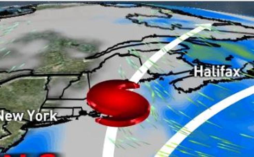
Option 1: This is a best-case scenario for Maine. In this scenario, the high pressure to our east is weaker, and the front moving into New England is strong. The front will push Lee out to sea in this situation, and the weaker high pressure would not “block” Lee from being pushed out to see. In this scenario, impacts in Maine would be limited to big waves, strong currents, and maybe some coastal flooding.
Option 2: In this scenario, the high pressure to our east is much stronger, forcing Lee to the west closer to the New England coast. The front is also weaker in this scenario and doesn’t do a good job of pushing Lee offshore. In this case, Lee would track either right along the coast of New England or potentially even making a landfall in Maine or elsewhere in the region. Regardless of a landfall, this scenario would have major hurricane impacts in parts of the state with storm surge, flooding rain, strong winds, power outages, and widespread damage.
Bridges goes on to explain that each of these scenarios remain fairly likely and probably will until the storm moves a bit closer. It's also worth noting that the last time a hurricane made landfall in Maine was back in 1991. Bridges says that a hurricane impact on New England would be 'devastating'.
We will keep this story updated as more information becomes available.
Do You Remember These 8 Crazy Maine Weather Events?
More From 92 Moose