How Will Winter Storm Izzy Affect Augusta / Waterville?
UPDATE: 5 PM on January 16th, 2022
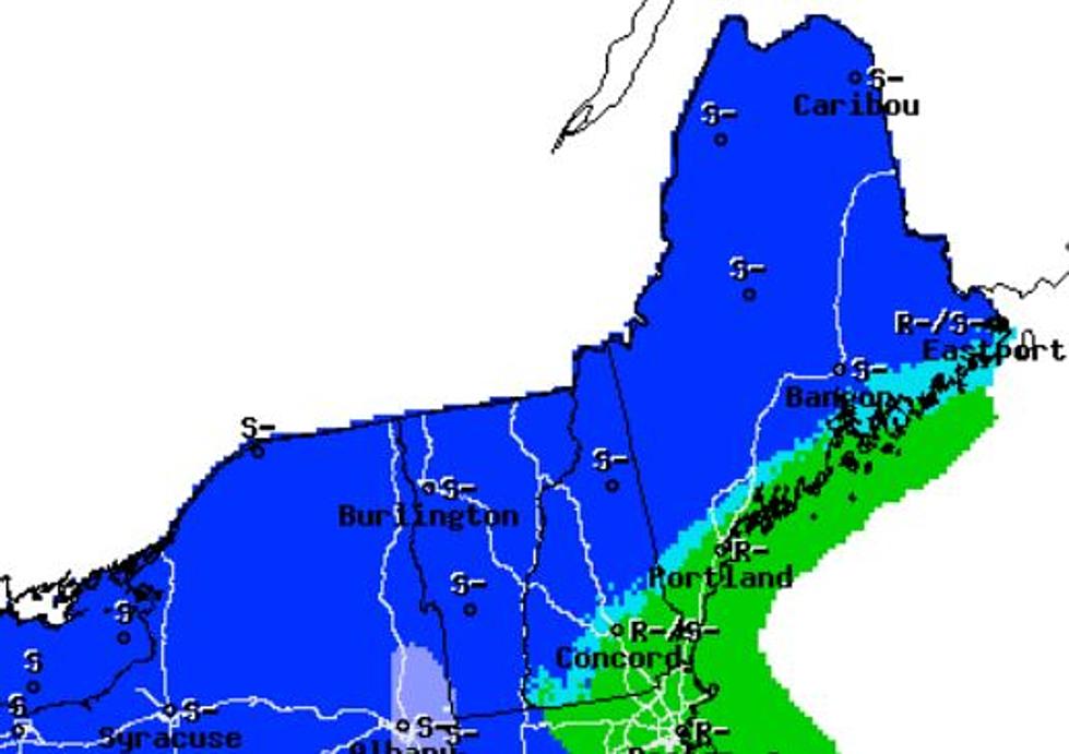
According to The Weather Channel, there is a winter storm warning in effect for Central Maine from 1 AM on Monday to 4 PM on Monday.
The snow is supposed to start in the Augusta / Waterville area at around 4 AM on Monday. The area will see a mix of rain and snow through 4 PM on Monday. The high will be about 47 degrees and we'll see winds of up to 35 miles per hour. Wind gusts could be over 40 MPH. The total snow accumulation could be about 5 inches.
Original post follows...
It looks like there is a really good chance that Winter Storm Izzy will shut down parts of the East Coast of the United States this weekend.
According to The Weather Channel, the storm will bring precipitation to about 1/3 of the country - from the Great Lakes east. And, it looks like some of the southern states will get the worst of it. Some cities could get as much as a foot and a half of snow!
It looks like it is going to be a lot more tame here in New England, though.
Currently, Weather.com is calling for most of Central Maine to see the storm roll in about midday on Monday. It is going to be more of a "mess" than anything. For Augusta, the temperature will be in the low 40s, gusty winds, with lots of rain and some snow. Total accumulation for the storm could be as much as 8". The rain and snow will continue through Monday evening.
The coast (Rockland, Camden) will be warm and windy. The expected high for Monday is about 43 degrees with wind gusts up to 35 miles per hour.
If you are a skier, snowboarder, or a snowmobiler, the storm will make you smile from ear to ear. The mountains of Western Maine and the White Mountains of New Hampshire could see up to a foot of accumulation.
The great news is that it looks like Tuesday will be a beautiful, sunny, day.
Be safe and remember that this is just a part spending winter in New England.
Do You Remember These 8 Crazy Maine Weather Events?
More From 92 Moose