Icy Sunday Could be in The Works for Much of Maine
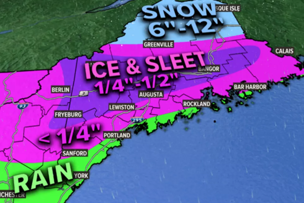
According to the National Weather Service, we could be in for some icy, nasty weather late Saturday night and Sunday.
A winter storm watch is in effect for Saturday evening through Sunday evening.
* WHAT...Heavy mixed precipitation possible. Total snow
  accumulations of up to 3 inches and ice accumulations of around
  four tenths of an inch possible.

* WHERE...Portions of northern New Hampshire and south central,
  southwest, west central and western Maine.

* WHEN...Freezing rain and sleet are expected Saturday evening
  into Sunday evening, and may be moderate at times. Precipitation
  may end as a brief period of snow.

* IMPACTS...Power outages and tree damage are likely due to the
  ice. Travel could be very difficult.
According to News Center, "dangerous ice" is in the forecast, particularly Sunday, with the worst time being 6 a.m. through noon on Sunday. The forecast is for the storm to start to move out after noontime.
News Center Meteorologist Todd Gutner said, "a half inch of ice is possible and scattered power outages are likely."
Gutner added that he does not expect a big storm like the 1998 ice storm, "I want to stress that this will not be anything like the Ice Storm of 1998. For one, this is a very fast mover. The Ice Storm of '98 lasted days. Secondly, the airmass preceding the storm will be incredibly warm. While I've seen ice occur following warm ups like this, getting epic ice events are more rare," he said.

More From 92 Moose


